Mapping Manhattan in 3D: A Technical Exploration
As a long-standing item on my to-do list, creating a detailed 3D map of Manhattan and its surrounding boroughs has been a project I’ve been eager to tackle. I’ve long had an appreciation and love for the city, its layout and the history of Central park. My father was born in Queens and raised me in Ohio before returning there to retire after 65 years away. This endeavor holds personal significance, allowing me to revisit and explore the urban landscape.
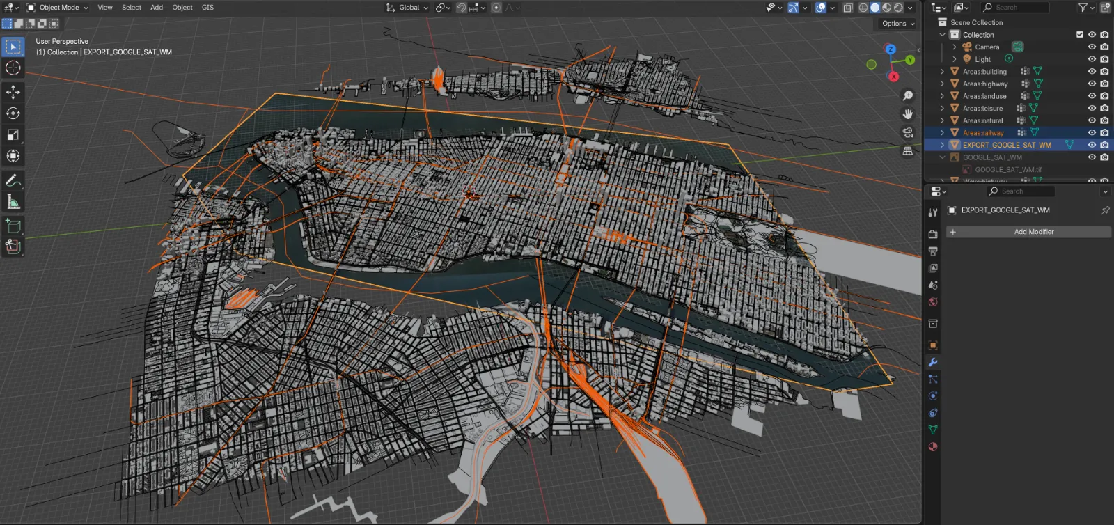
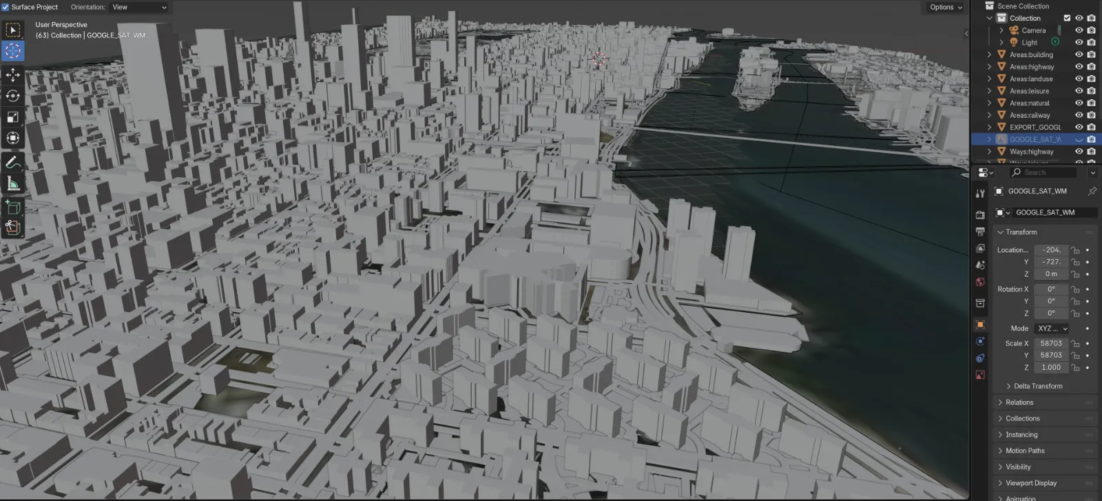
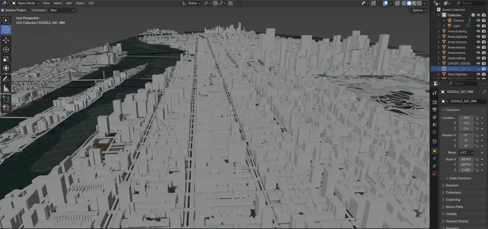
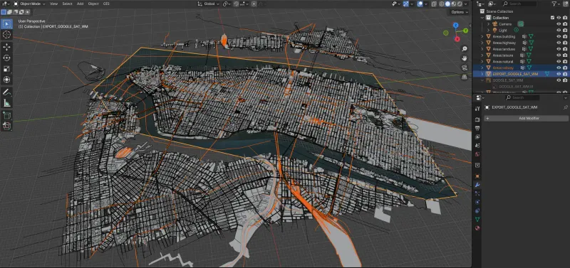
The process involved a multi-faceted approach, requiring the mastery of various tools and techniques. First, I delved into learning Blender, a powerful 3D modeling and animation software, to serve as the foundation for this project. With Blender’s robust capabilities, I was able to import data from Google Maps and overlay it with GIS (Geographic Information System) data, allowing me to accurately represent the intricate details of the city’s infrastructure.
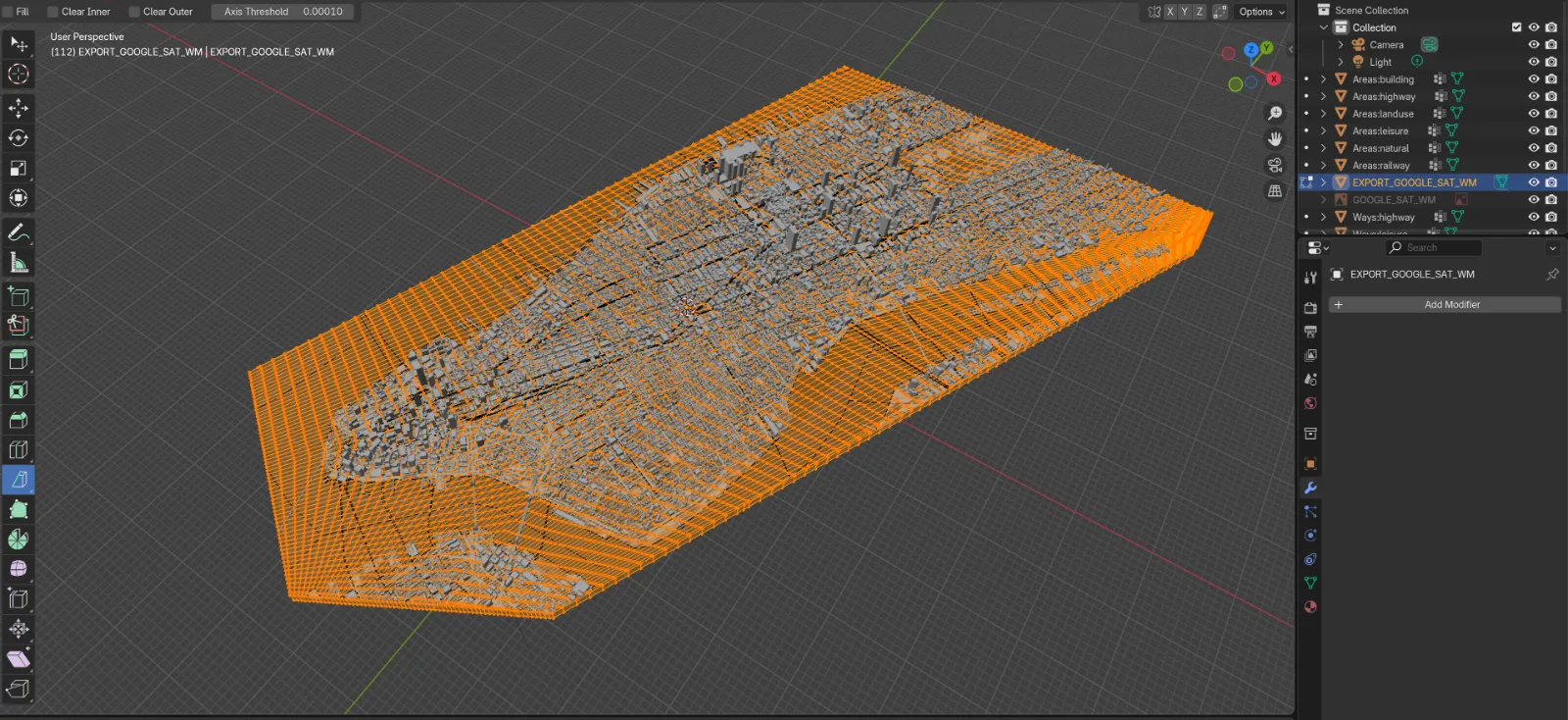
One of the key challenges was the ability to select and transform individual elements, such as roads, bridges, tunnels, and various structures, from their 2D representations to fully-fledged 3D models. This process involved careful data manipulation and precise modeling techniques to ensure the final 3D map captured the nuances of the urban landscape.
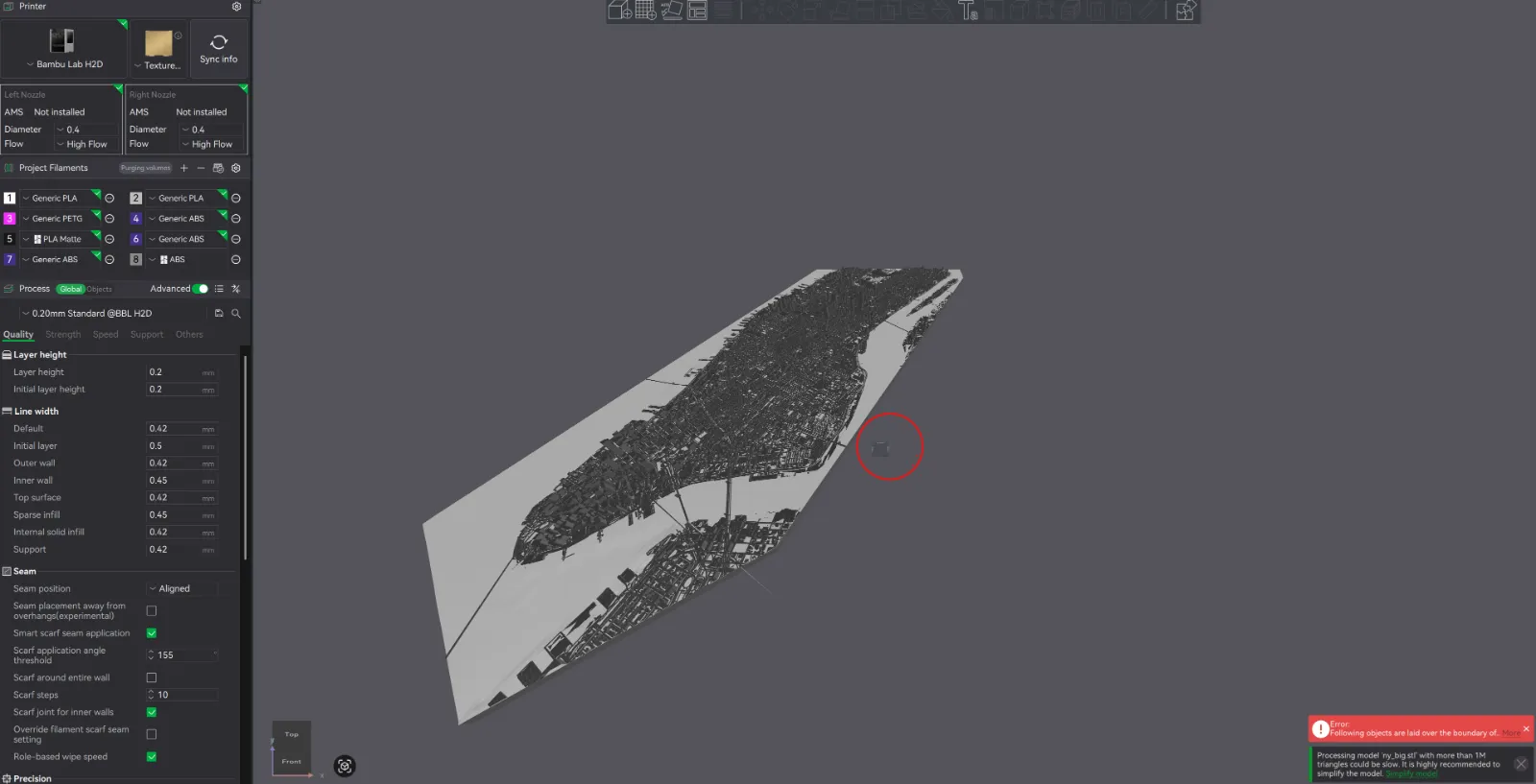
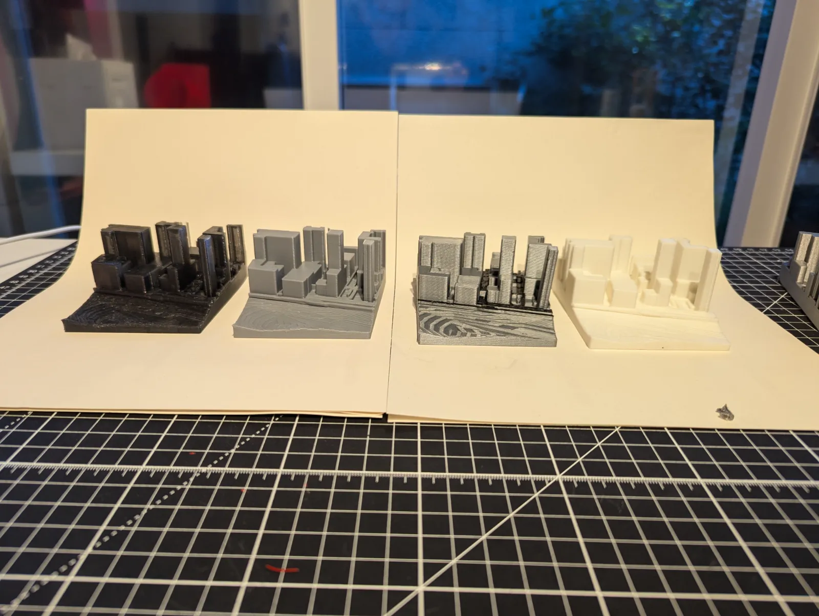
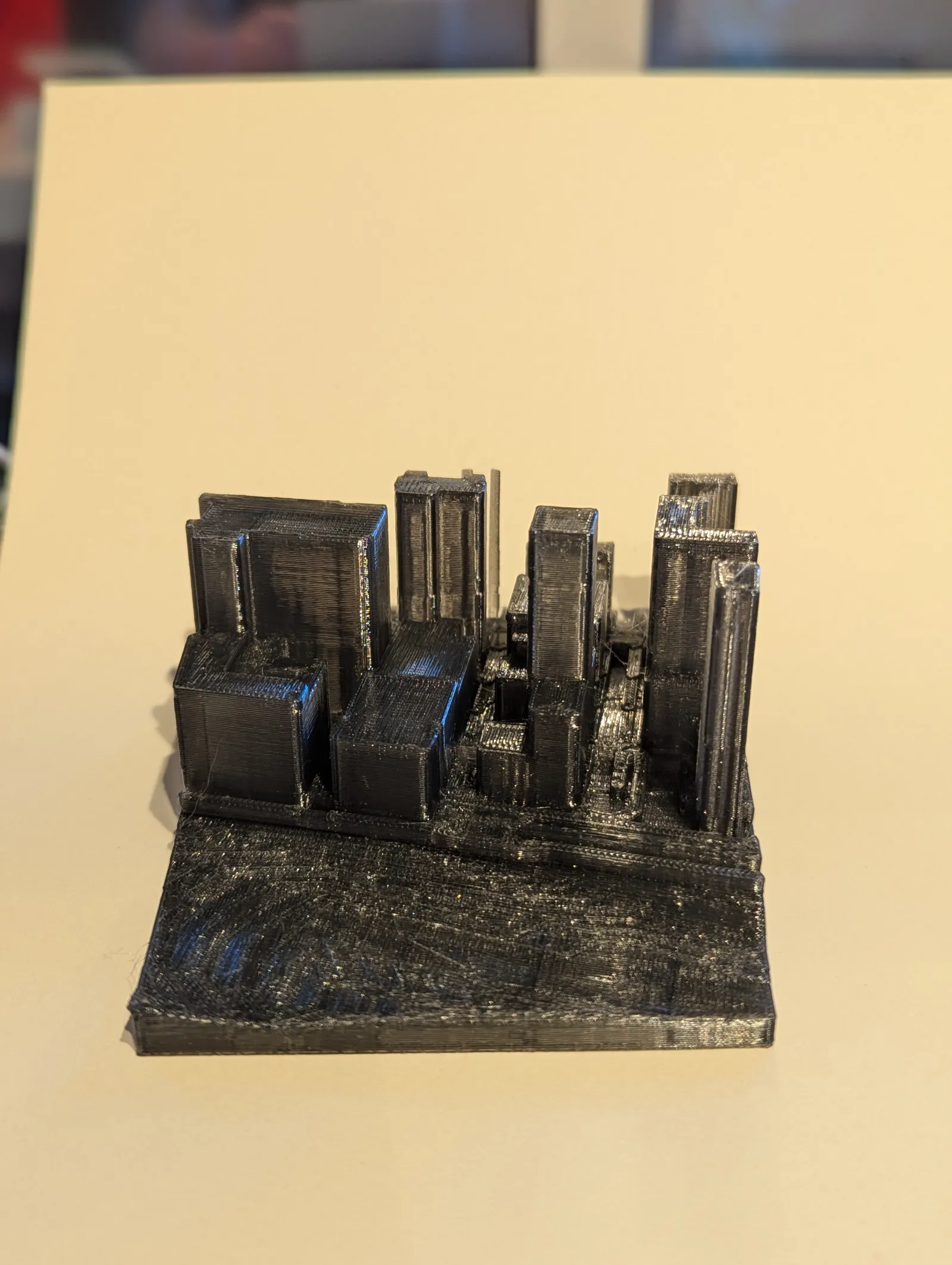
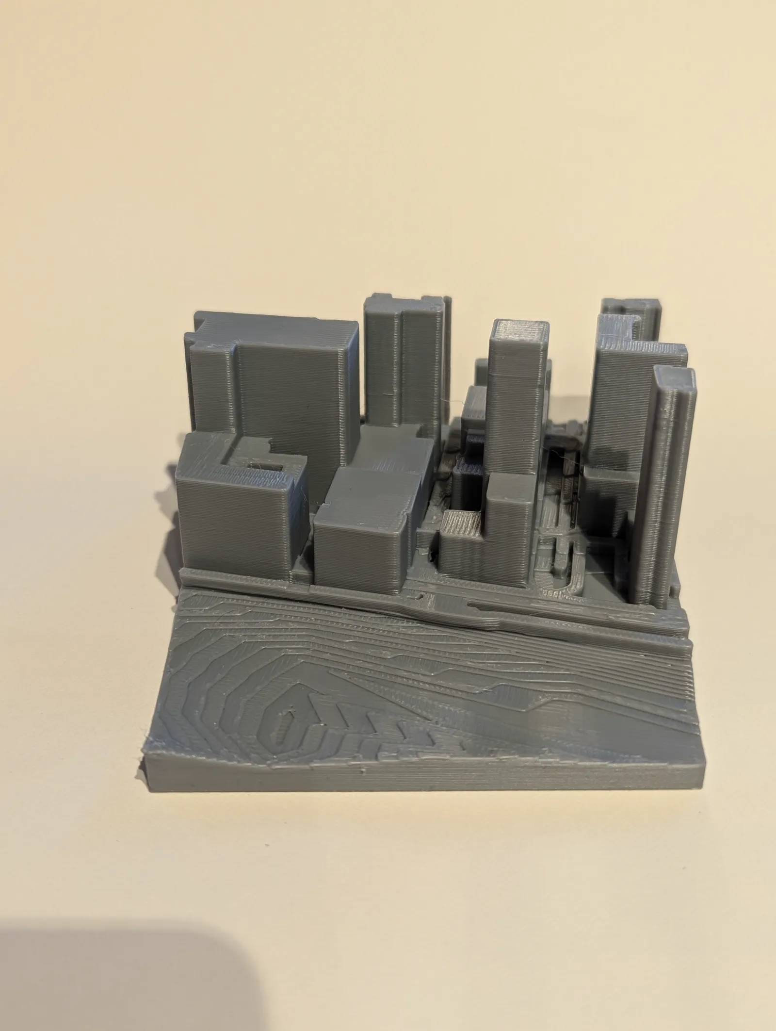
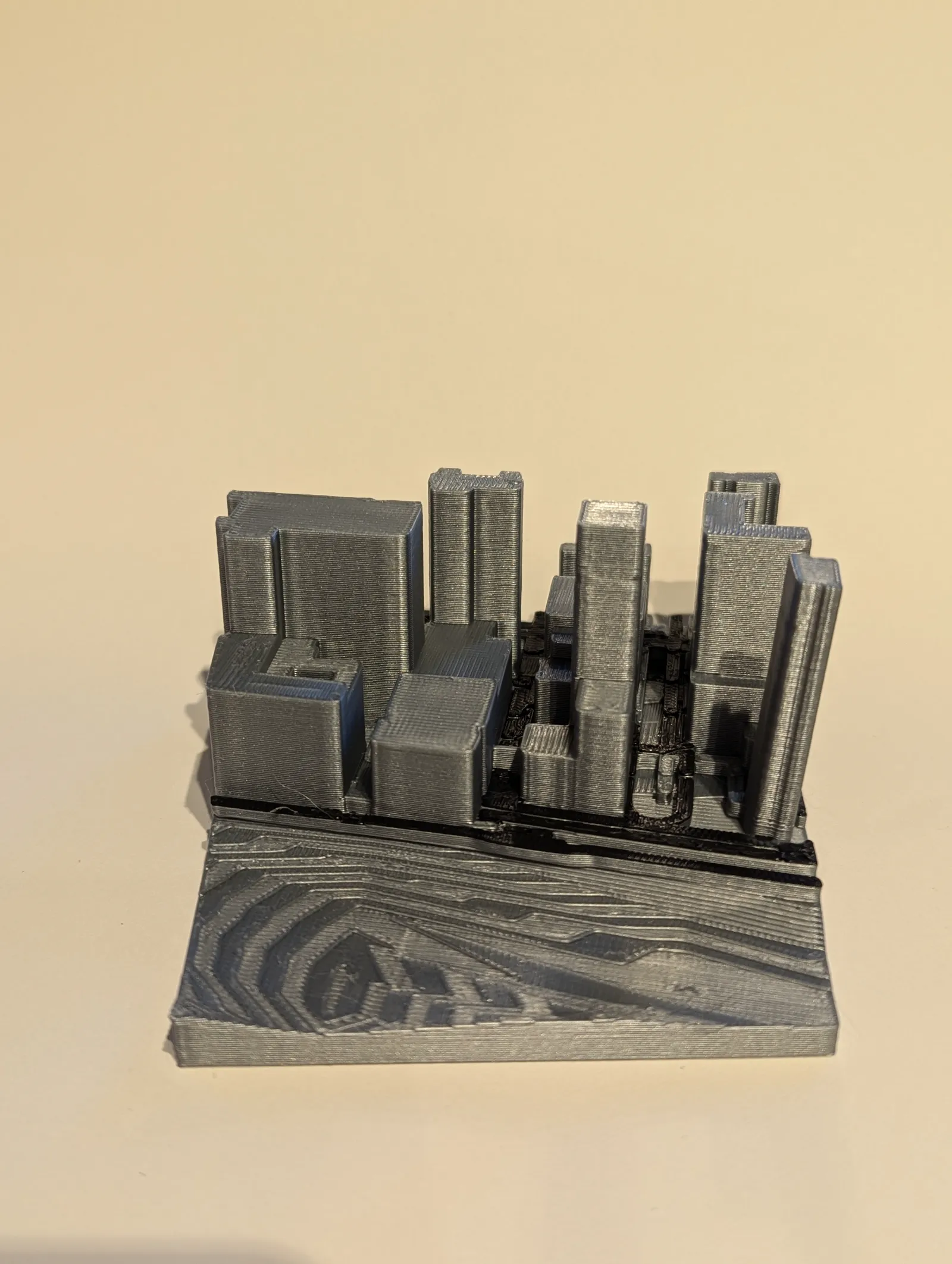
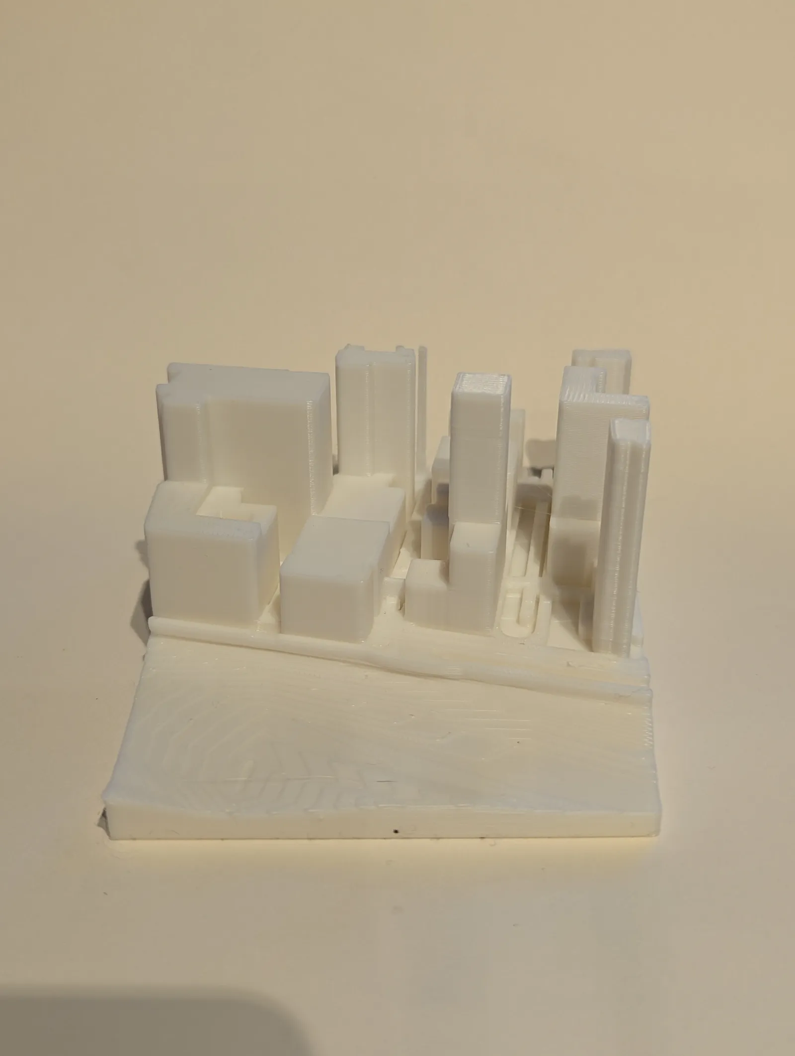
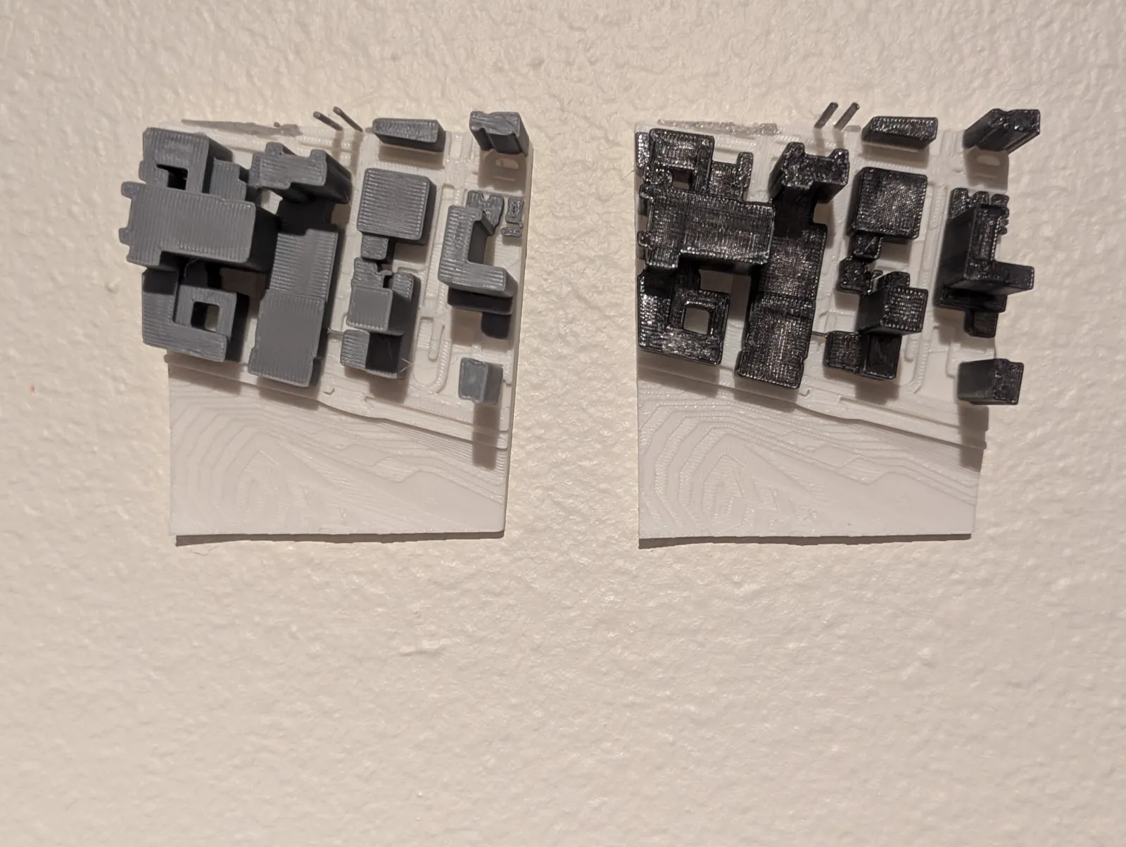
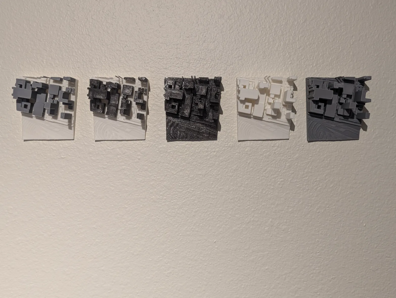
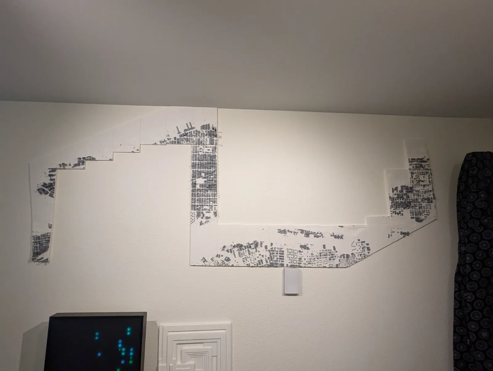
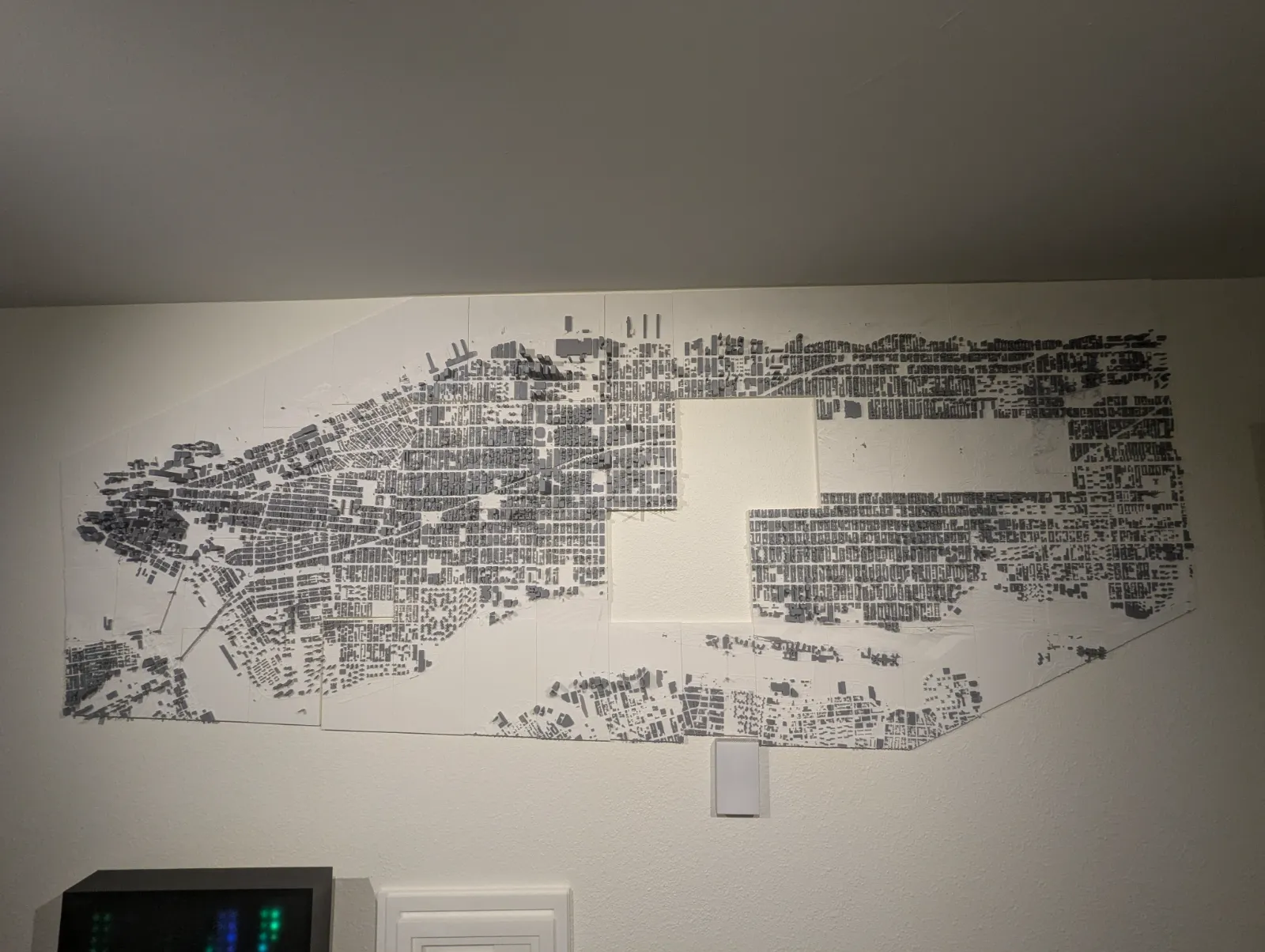
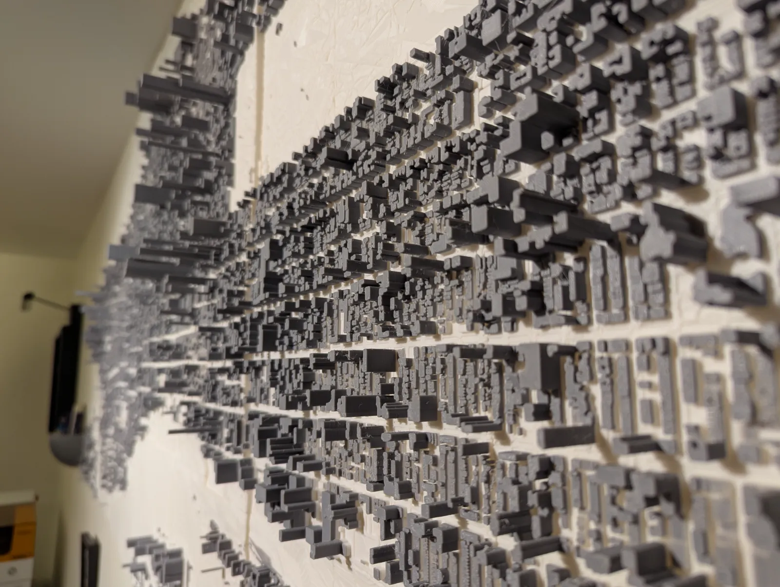
After meticulously shaping the 3D map, the next step was to refine and prepare it for 3D printing. This entailed cutting and trimming the map to fit within the constraints of the print bed, as well as splitting the model into individual tiles for efficient printing and assembly. By leveraging slicer software, I was able to generate the necessary instructions for the 3D printer to fabricate each tile accurately.
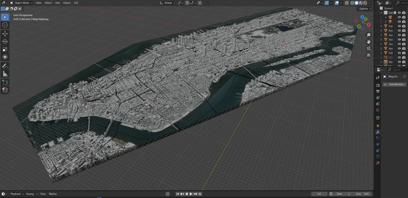
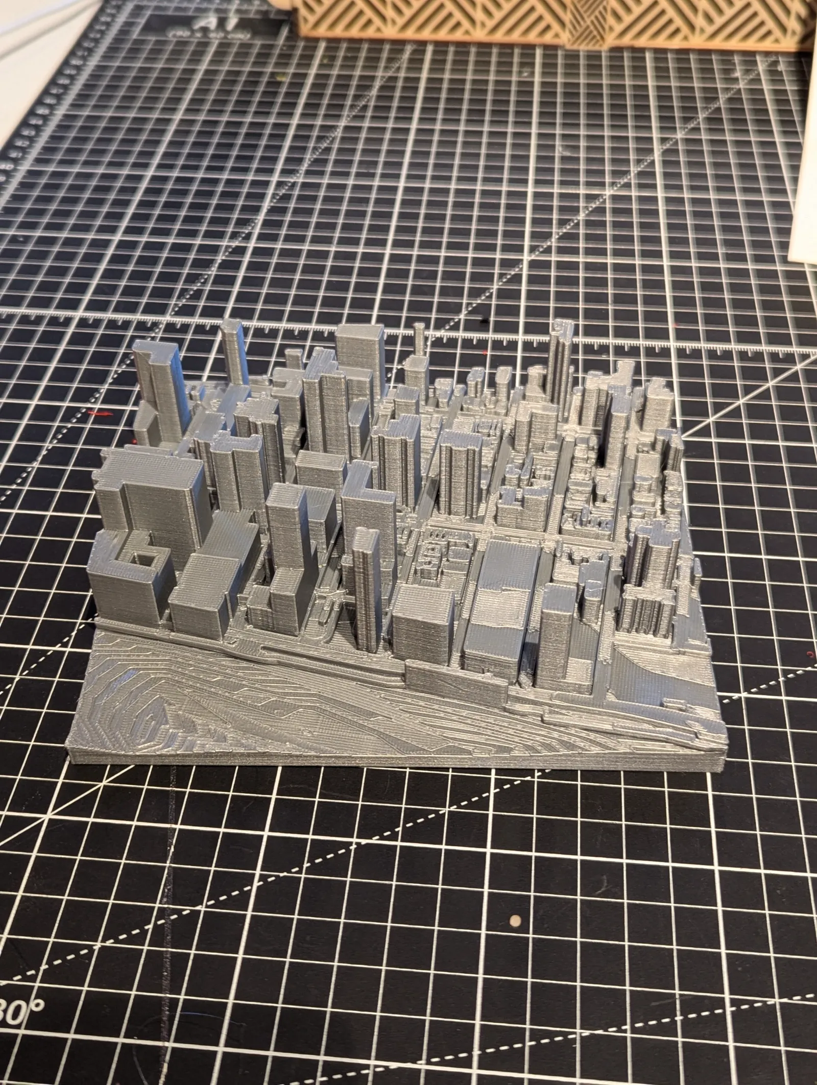
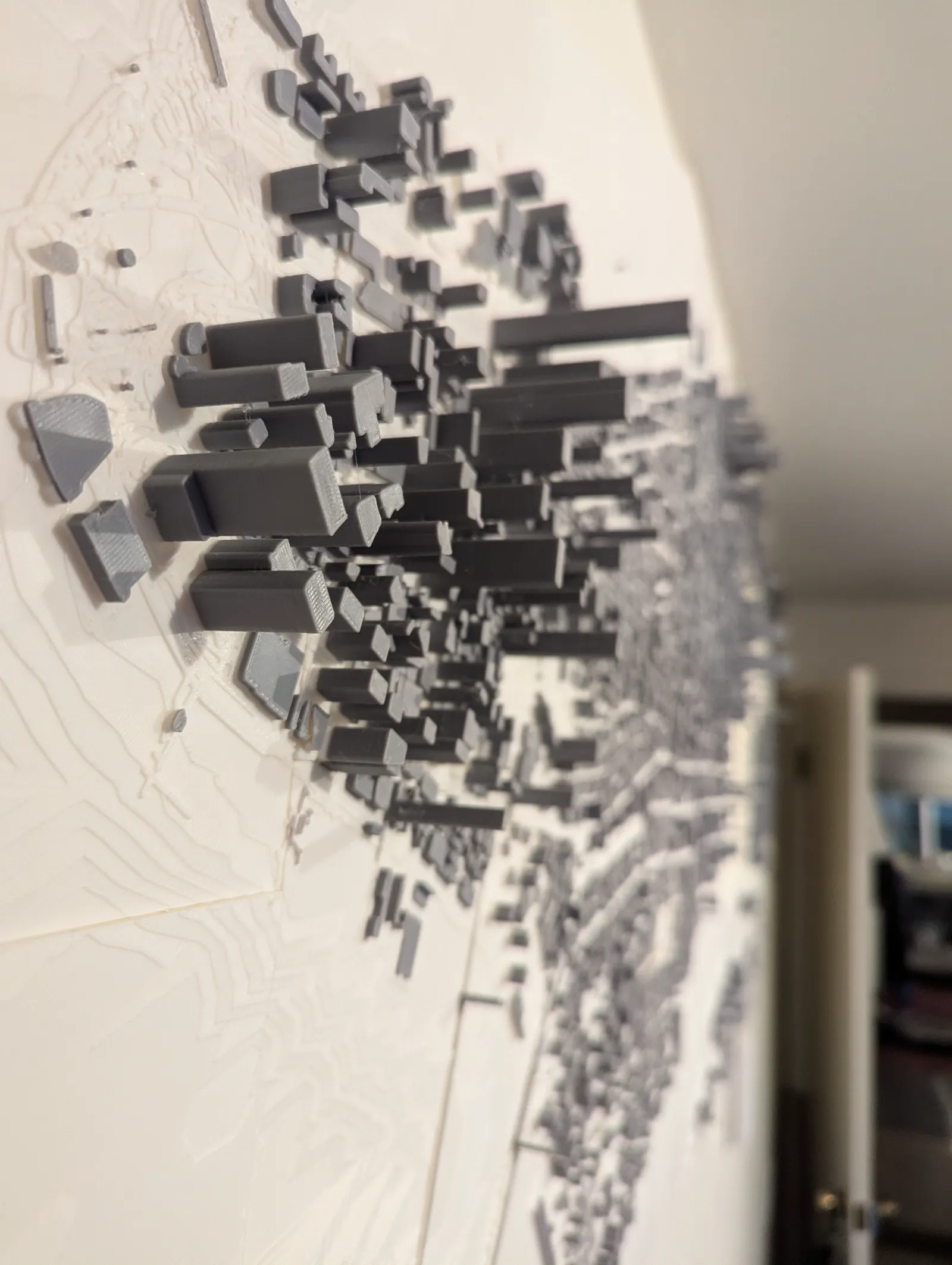
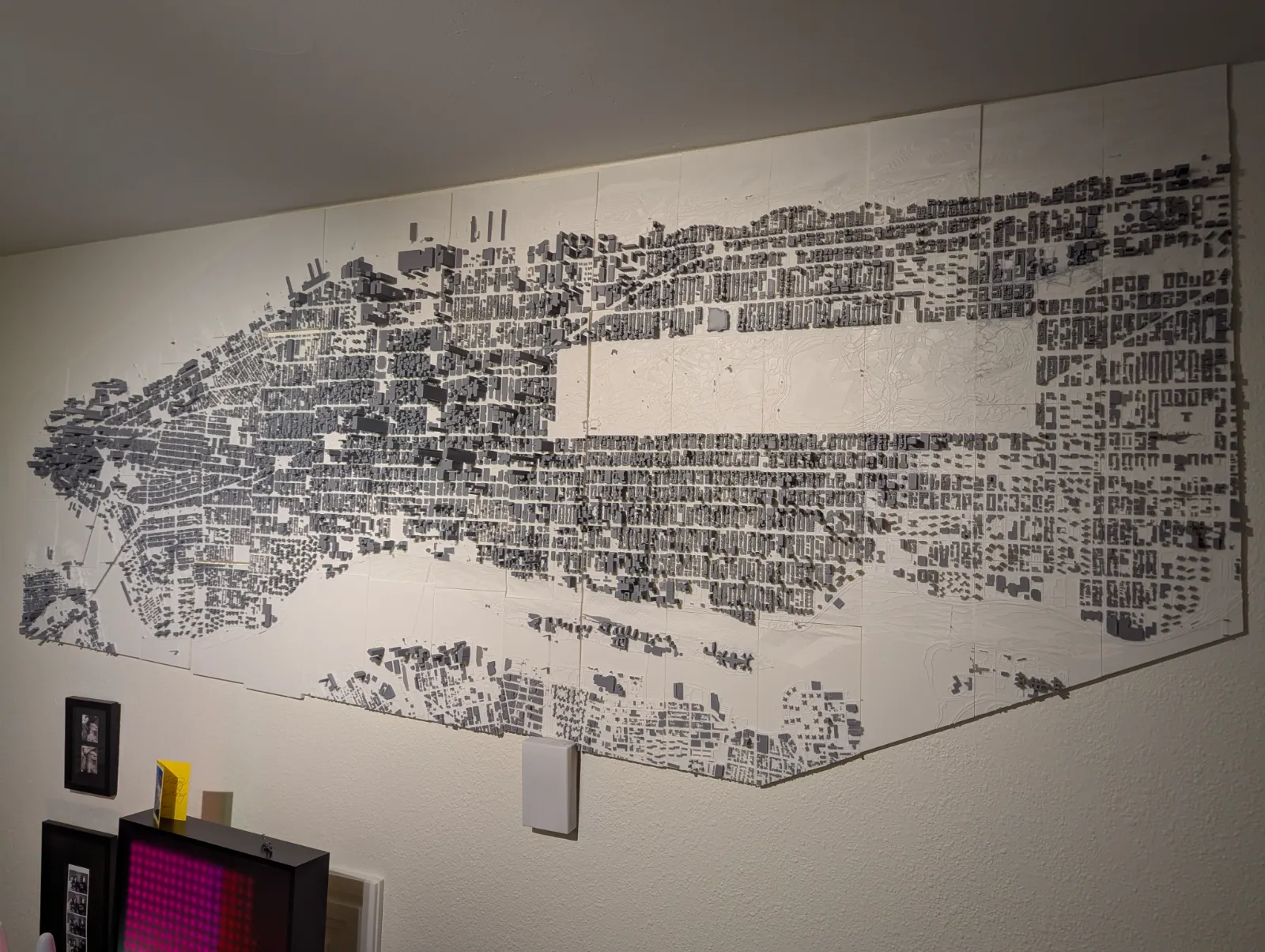
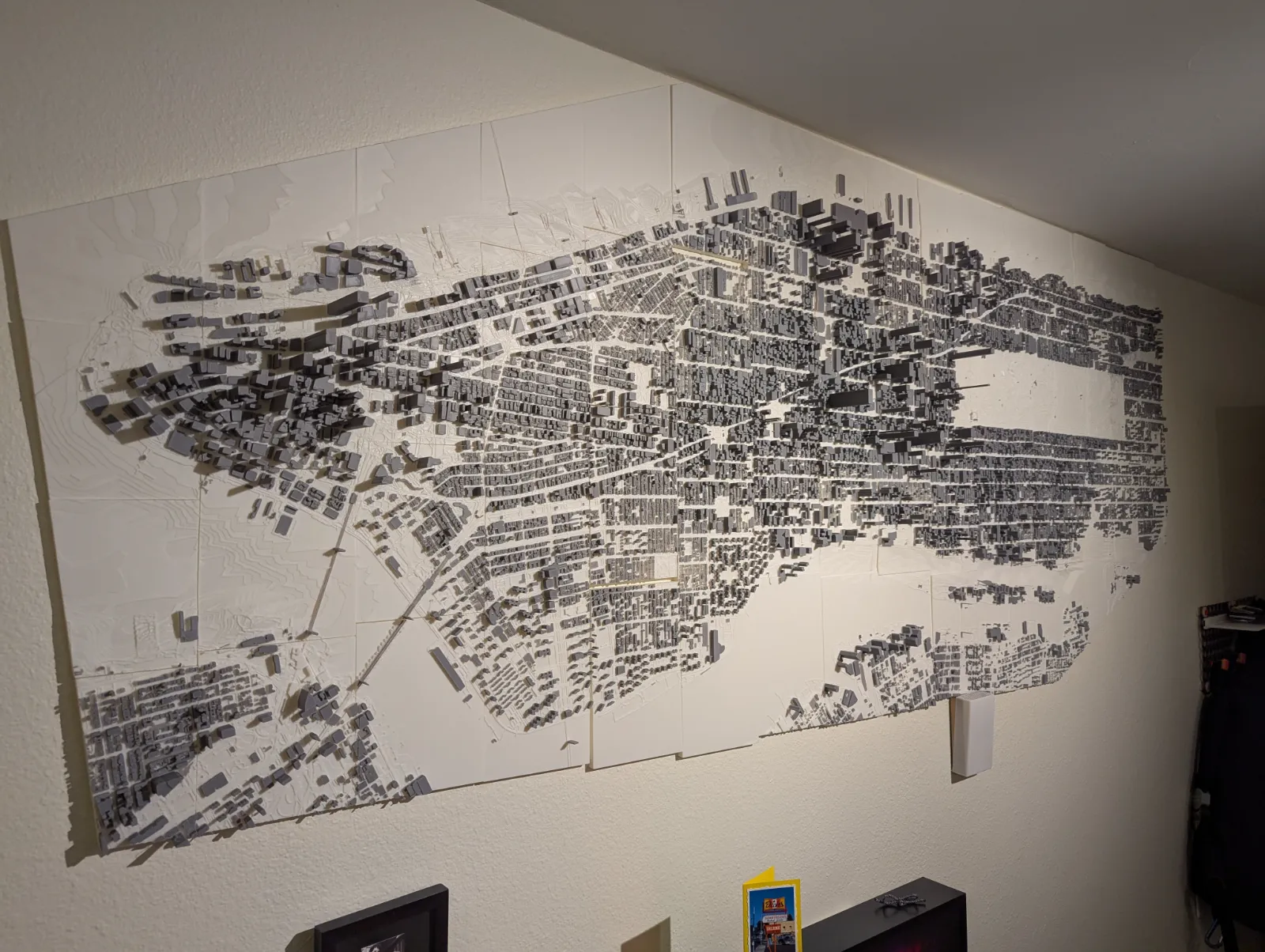
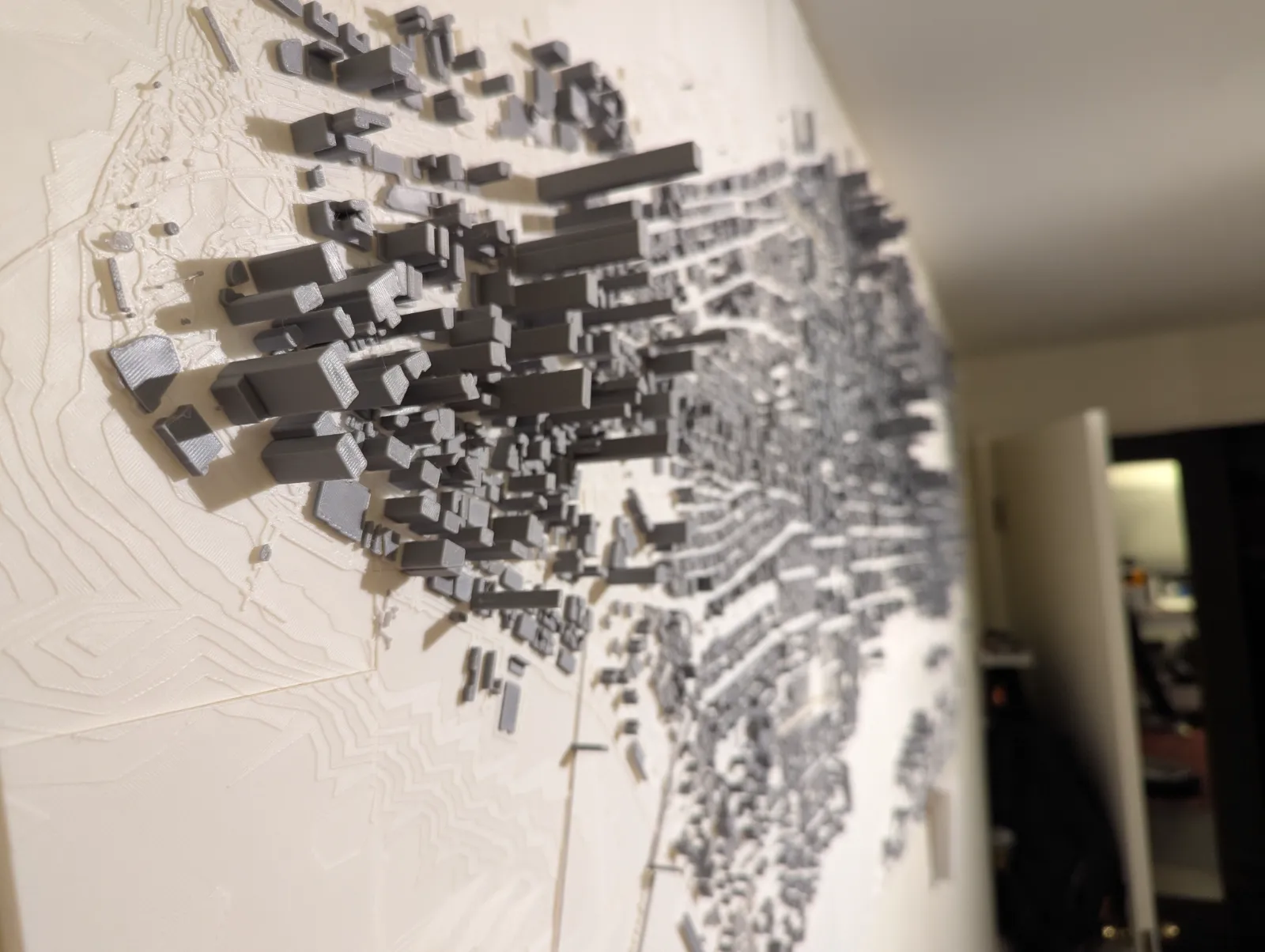
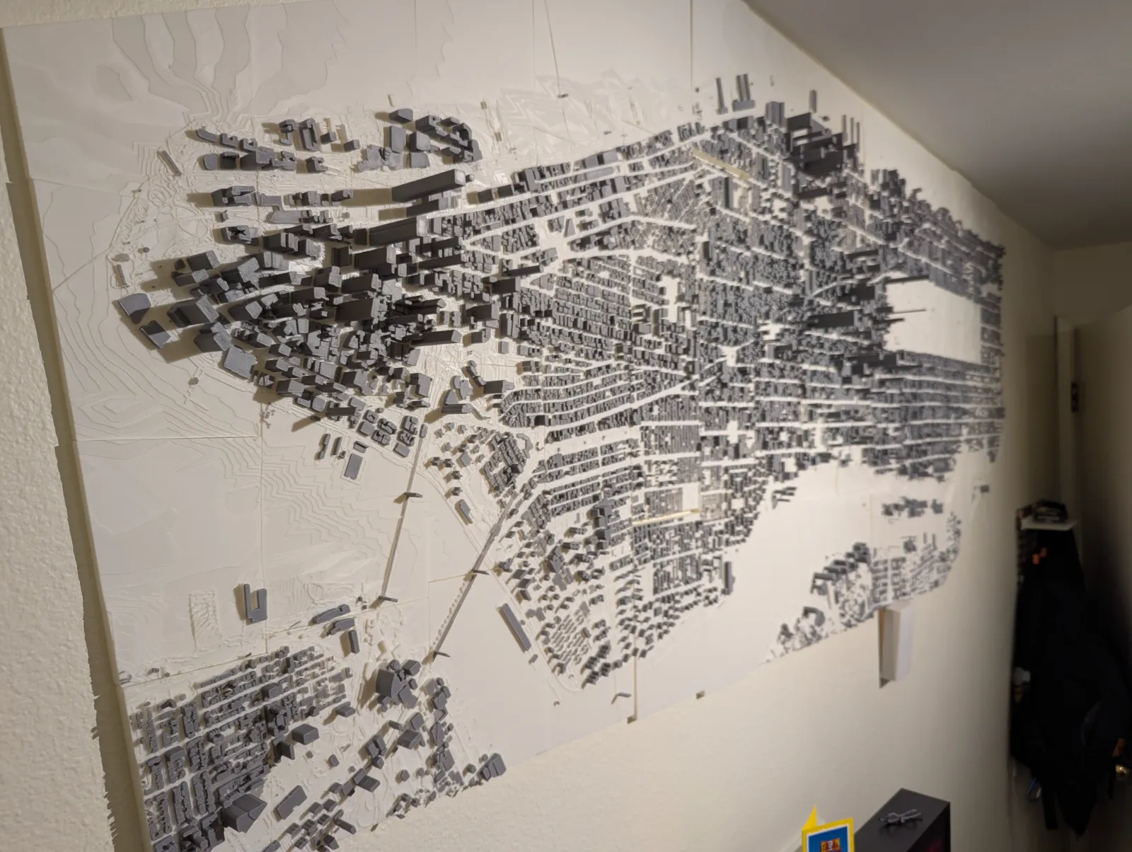
The culmination of this project was the successful 3D printing and assembly of the individual tiles, resulting in a comprehensive and visually stunning 3D representation of Manhattan and its surrounding areas. This process not only allowed me to explore my personal connection to the city but also pushed the boundaries of 3D mapping and digital fabrication.
Through this technical endeavor, I’ve gained valuable insights into the intricacies of 3D modeling, data manipulation, and the integration of various tools and technologies to bring a complex urban landscape to life. This project serves as a testament to the power of combining creativity, technical expertise, and a deep understanding of one’s surroundings to produce innovative and meaningful works.
Reference Images